Typhoon yellow warning: "Du Surui" has weakened to a strong tropical storm level and is expected to move into the eastern part of Jiangxi in the early morning of the 29th.
CCTV News:According to the website of the Central Meteorological Observatory, the Central Meteorological Observatory issued a yellow typhoon warning at 18: 00 on July 28.
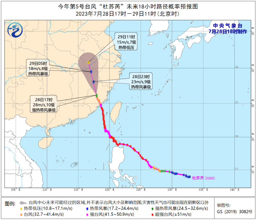
This year’s No.5 typhoon "DOKSURI" weakened to a strong tropical storm level in Sanming City, Fujian Province at 4 o’clock this afternoon (28th). At 5 o’clock in the afternoon, its center was located at 26.2 degrees north latitude and 117.9 degrees east longitude, with a maximum wind force of 10 (28m/s) and a minimum pressure of 988 hectopascals.
It is estimated that "Du Surui" will move to the north-west direction at a speed of about 30 kilometers per hour, and will move into the eastern part of Jiangxi in the early hours of tomorrow, and its intensity will gradually weaken.
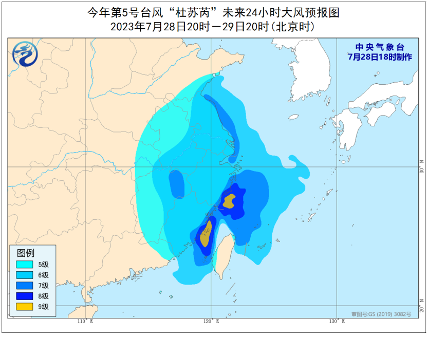
Gale forecast:From 20: 00 on the 28th to 20: 00 on the 29th, there will be 5-7 winds in the western Yellow Sea, the central and western East China Sea and the waters near Diaoyu Island, the Yangtze River estuary, Hangzhou Bay, Taiwan Province Strait, and eastern Guangdong, Fujian, Zhejiang, Jiangxi, Shanghai, Jiangsu, Anhui, eastern Hubei and southeastern Shandong, with 8-9 winds and 10-11 gusts in some sea areas or regions.
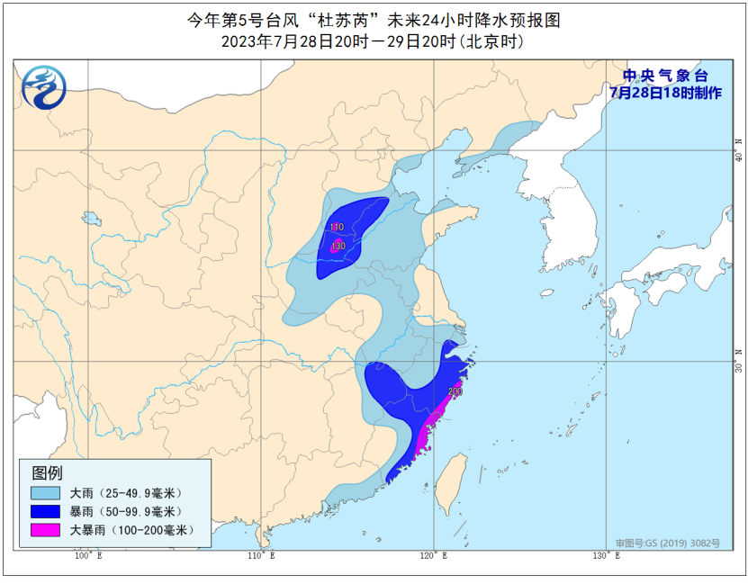
Precipitation forecast:From 20: 00 on the 28th to 20: 00 on the 29th, there were heavy rains in most parts of Fujian, the eastern coast of Guangdong, Zhejiang, northeastern Jiangxi, Anhui, northwestern and southern Jiangsu, most of Henan, southeastern Shanxi, central and western Shandong, eastern and southern Hebei, eastern Liaoning and other places, including heavy rains (100-200mm) in parts of southern Hebei, northern Henan, eastern Zhejiang and northeastern Fujian.
Defense guide:
1. The government and relevant departments shall, in accordance with their duties, do a good job in typhoon prevention and emergency rescue.
2. Water operations and passing ships in relevant waters should return to Hong Kong to take shelter from the wind, strengthen port facilities, and prevent ships from anchoring, grounding and collision.
3. Stop large-scale indoor and outdoor gatherings and dangerous outdoor operations such as high altitude.
4. Reinforce or dismantle structures that are easy to be blown by the wind. Personnel should not go out at will. They should stay in windproof and safe places as far as possible, so as to ensure that the elderly and children stay in the safest place at home, and the dangerous people will be transferred in time. When the typhoon center passes by, the wind will decrease or stay still for a period of time. Remember that the strong wind will suddenly blow and you should continue to stay in a safe place to avoid the wind.
5. Relevant areas should pay attention to prevent flash floods and geological disasters that may be caused by heavy precipitation.